Sunset in the Coconino National Forest, looking northeast toward Sedona, AZ, 4/17/15

Saturday, July 31, 2010

Actual Travel Route, April-July 2010

The map below traces out my travel route from April through July ... from my Washington State home to the top of Minnesota ... visiting national parks, friends and family.  It's not exact, but very close my actual route.


I also took a lot of side trips.   The route above calculates to about 15,000 miles, whereas I actually put on more than 20,000 miles.  I'm averaging about 45 MPG.

To say the least, it's been a great adventure so far ... and I still have the east coast and more to explore!

originally posted 9/11/10

Voyageurs National Park (MN), July 26-31

A Voyageur with items to trade for beaver pelts.
An Ojibwe woman behind the birch bark canoe.
Before I talk about Voyageurs National Park, I've got to tell you that I traveled to this national park by driving the shorter distance through Canada (vs. through Minnesota).  Bolstered by my relative success of an afternoon visit to Thunder Bay, Ontario, I decided to go from Grand Portage to International Falls via Ontario's Hwy 11.  My travel through Canada was both beautiful and uneventful.  Getting back into the US, however, was another story!

Evidently my explanation about visiting the National Parks didn't cut it with the US border patrol officer, so he had me pull off to the side to be searched. And then when I explained to the next officer that I really didn't have a dog, that the big dog bowl was there just so that it appeared as though I had a big dog for safety reasons ... I got a disbelieving look. And then when she asked why I had two chairs when I was traveling alone, I don't think my explanation about making it look like someone else was with me was getting any understanding either.

Beavers are still plentiful in the area.
Here is a tree one fell recently.
So, off to their "office" I went, filled out a form assuring them I was bringing nothing Canadian back with me, emptied my pockets and turned them inside out ... while they performed a background check on me. I waited and watched as two other officers started wading through, unzipping, and inspecting all of the variety of bags, drawers, duffel bags, packs, etc. in my car. I've got nearly every cubby hole, and space under and behind the seats stuffed ... I figured I was going to be there for a while. So, I might as well sit back and enjoy watching their efforts.

Just as I was getting comfortable for the show, they decided that I was actually telling the truth and stopped searching ... or, maybe they just didn't want to look through everything once realizing all I had stuffed in there ... or, maybe it was all of the national park brochures in my laptop case that tipped them off.

So, after doing a bit of re-packing, I was off to Voyageurs National Park.  Besides being a wonderful park with all kinds of waterways, it's also a place full of history and adventure.  Voyageurs were French Canadian traders who used birch bark canoes to transport goods for trade.  Primarily they traded blankets, metal ware and tools, beads and jewelry for beaver pelts.  The Voyageurs then canoed the pelts to Montreal to be shipped to Europe where beaver felt top hats were all of the rage.  (If you read my blog post on the Grand Portage National Monument, this will sound similar.)

Although I didn't see any, I'm told that
moose are plentiful in the park.
Not only did the Voyageurs trade with the Ojibwe, but adopted many of their traditions and technologies.  Voyageurs needed to be very strong.  When they portaged their canoes, they also needed to carry on their back 90-180 pounds each of pelts or trade goods.

Voyageurs NP is primarily a water-based national park.  So, I took a couple of ranger-led canoe paddles.  One was a reenactment, as though we were paddlers for the NW Trading Co. on a reproduction Voyageur birch bark canoe.  The second was a nature paddle in a modern canoe along the shoreline.

Canoes aside, I don't think I've ever seen so many empty boat trailers in parking lots before, in my entire life.  Every water access point had dozens of parked pickups with empty boat trailers.  And the Saturday evening I left the park, 99% of the pickup trucks I passed on the highway were hauling a motor boat.  Needless to say, boating is a major pastime here!

Although Voyageurs NP only has campsites on its islands, I found Woodenfrog State Park right on the water.  It was a quiet campground, and somewhat central to the various places I wanted to visit. 

What I think I'll remember most about Voyageurs, however, are the loons.  Their eerie vocalizations seemed to be always around you ... some of which I'd never heard before.  Their wails and yodels were especially confusing to me at first.  Go to this Looney Tunes page to take a listen for yourself.

originally posted 9/10/10

Monday, July 26, 2010

3 Campgrounds on the Northeastern Tip of Minnesota, July 22-26

Schooner and full moon.
View from where I blogged in
Grand Marias, MN.
Between exploring Grand Portage National Monument and Isle Royal National Park, I also took some time to do some online tasks while in the area.  I found a wonderful place with wifi in Grand Marias near their City Campground and Marina.  Although their rates are steeper than I like to pay, I did get a nice shower and a chance to explore their wonderful town.  Grand Marias is where I found a spot to update my blog with a view.

I also stayed a couple of nights at Judge C.R. Magney State Park Campground.  I loved to return to my quiet little site after a busy day.  The Devil's Kettle hike and waterfall are beautiful.  It was less expensive than the city campground at Grand Marias, but not as inexpensive as the little campground above the marina at the Grand Portage Casino. 
View from campsite at the
Grand Portage Casino Campground

If I were to do it all again, I'd spend every night at the Grand Portage Casino Campground.  The view and people watching opportunities were great.  The bathrooms and showers were fairly close by.  It was patroled regularly by security.  And, at $12 per night (tent site), was the least expensive option in the immediate area that I found.  My campsite neighbors said that the casino's restaurant was good for the money as well.


originally posted 9/9/10

Sunday, July 25, 2010

Isle Royale National Park (MI), July 25

400 year old Little Spirit Cedar Tree
in the middle of the frame
Isle Royale National Park is the least visited national park in the contiguous 48 states.  But, it has the highest return rate of any national park.  It's a beautiful island archipelago in northwest Lake Superior.  Although it's closest to Minnesota's mainland, it resides within Michigan's boundaries.  I chose to sail aboard the MV Wenonah for a day trip from Grand Portage on the most northeastern tip of Minnesota.

Water sparkled
like diamonds
We cruised past a very old "Little Spirit Cedar Tree" perched on the shoreline, believed to give protection to ships on the water.  The lake sparkled like diamonds.  We were shown a shipwreck of the 1920's steamship "America" just below the water.  And on the return trip, sailed past the Rock of Ages Lighthouse. 

Rock of Ages Lighthouse
We landed at Windigo on Isle Royale, where I had time to explore the little museum and go on a ranger-led nature hike.  I can see why people want to return ... I do!  It's a beautiful island wilderness with both moose and wolves.  No poisonous snakes, spiders or plants.  And, you can fish in the island's lakes without a license.

Wenonah docked at Windigo
For this day trip, most of the time is spent on the water.  While on the hike and then on the return trip, I visited with Ron and Donna, a charming retired couple from Maine (who winter in Florida).  They were camping their way cross-country to visit national parks as well.  Their journey was taking them east to west, however.  I thoroughly enjoyed visiting with them, both at Isle Royale and later running into them again at Voyageurs National Park.   They gave me some great tips about sites to see on the east coast.
Isle Royale wilderness begins here.

originally posted 9/8/10

Saturday, July 24, 2010

Grand Portage National Memorial (MN),
July 23-24

Anishinabe or Ojibwe Tepees
 covered with birch bark
Now in Minnesota, I went to the Grand Portage National Memorial on Lake Superior, very close to the Canadian border.  This is a reconstructed depot used by the Northwest Trading Company.  Now, I think of the northwest as those areas around my home in Washington State.  But, early in our country's history, Minnesota was the far northwestern territory of the country.

A Voyageur Camp outside of the fort
Most of the staff and volunteers at this park dress in period clothes.  At the time I was there, in the middle of the week, there wasn't too much going on.  But, I did get a lesson on making birch baskets.  I learned that birch bark is naturally waterproof.  The Ojibwe made some of their baskets in such a way as to hold water so that they could cook in them.  Their tepees were also covered in birch bark.  Similarly, the Ojibwe and later, the Voyageurs made their canoes out of birch.

An office in the fort
Just outside of the fort were the reenacted camps of the Ojibwe and the Voyageurs.  Within the walls of the fort were gardens growing antique crops, a working kitchen, offices and a mess hall.  At this depot, the Ojibwe and the Voyageurs would sell their beaver furs to the NW Trading Company.  Often the price of a beaver pelt was paid in blankets, iron tools, or guns.  The furs were then packed tightly in 90 pound packages and canoed further up to Montreal where they were shipped to Europe.  Top hats made of beaver felt were all the rage.

Inside the fort
kitchen on the left, mess hall on the left
I love birch trees, and here the hill sides were covered with them.  At first I was concerned about how many dead trees I saw.  But, I learned that logging in the area stopped about 70 years ago and that birch have a lifespan of 60 to 70 years.  So, the dead trees that I saw were mostly the old trees that had reached the end of their natural life.

Baking ovens just outside the kitchen
While in the area, I decided to go 45 minutes north to Thunder Bay, Ontario, Canada for the afternoon.  It was a dry run to make sure I had everything in order for Canadian travel to future destinations.  Everything went pretty good, both coming and going ... I did find out, though, that you can't take pepper spray into Canada unless it's meant for an animal, e.g., bear spray.

originally posted 9/7/10

Wandering and Pondering, July 24

I've been remiss at keeping up on my blog.  But, my travels have continued.*  Also, I've become somewhat introspective on this current portion of my journey. 

This afternoon, I've found a wonderful spot with some wifi to catch up on emails and do some blogs posts.  Where I'm parked, I look out  my front windshield onto a beautiful Lake Superior harbor (Grand Marais, MN), listening to a local folk singer at the farmer's market down the block.  Life is good.

Thank you for your patience as I catch up here.

*a friend's home (OK), Fort Smith NHS (AR), Hot Springs NP (AR), Natchez NHP (MS), Natchez Trace National Parkway (MS,AL,TN), Mammoth Cave NP (KY), Lincoln's Birthplace NM (KY), several friends' homes (OH), Cuyahoga Valley NP (OH), First Ladies NM (OH), James A. Garfield NHS (OH), Indiana Sand Dunes NL (IN), Sleeping Bear Dunes NL (MI), Keneewa NHP (MI), Isle Royale NP (MI), Apostle Islands NL (WI), Grand Portage NHP (MN)

Thursday, July 22, 2010

Apostle Islands National Lakeshore (WI),
July 22

ice house in fore left
herring shed on deck
pile driver raft on right
The Apostle Islands is another beautiful National Lakeshore on Lake Superior, but this time I'm in Wisconsin!  

type of boat brothers used
when first started fishing
On my way, I overnighted at Memorial Campground in Washburn, WI.  The campground is right on the lake, but I got the last campsite available and it was in the woods.  Even though it was just a Wednesday, the local high school was having their annual homecoming reunion that week so the campground was full.   After the usual curious inquiries from fellow campers about being there all of the way from Washington State, traveling solo, living out of a car, visiting national parks ... I got a good night's sleep. The next morning, I started exploring.

Inside the Herring Shed
The Apostle Islands National Lakeshore has 21 islands, but I spent my time exploring it's 12 miles of mainland coast.  I especially focused on an historical commercial fishing operation, The Hokenson Brother's Fishery.  I enjoyed this museum of rustic buildings and artifacts very interesting.  They were a very hardworking and enterprising group of 3 brothers.


originally posted 9/6/10

Wednesday, July 21, 2010

Keweenaw National Historic Park (MI),
July 20-21

View near Eagle Harbor
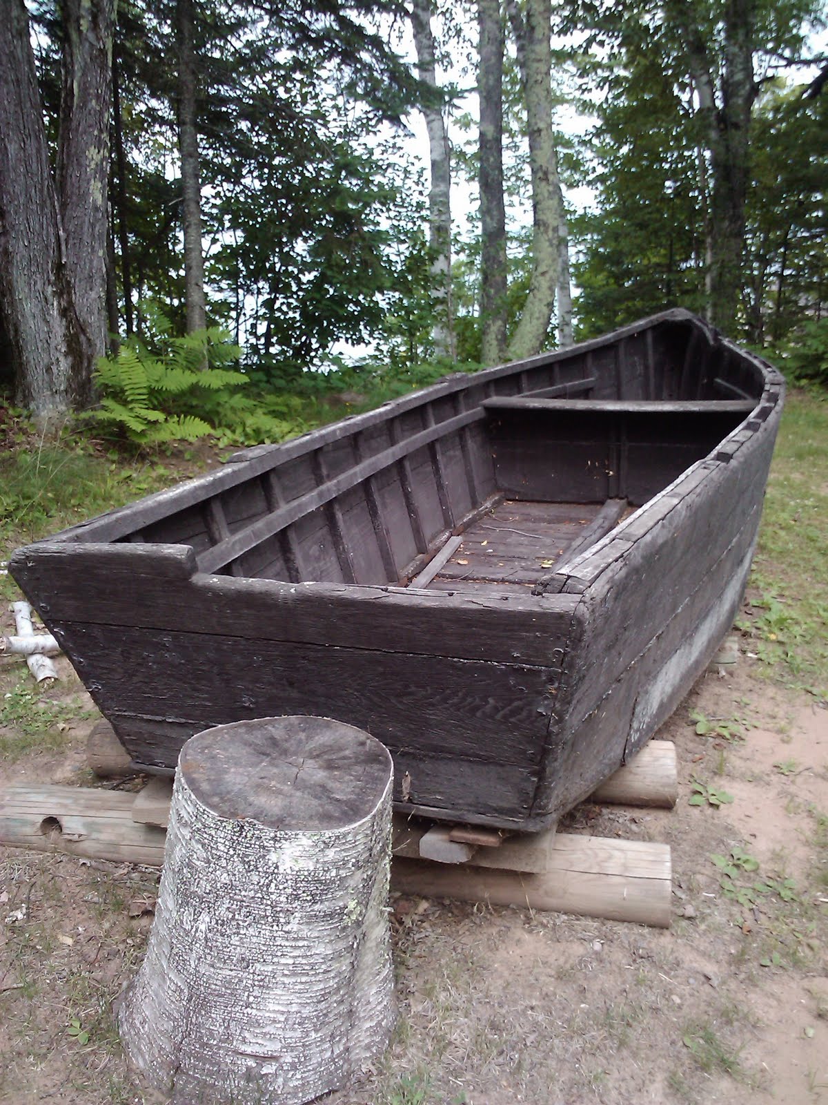
The Keweenaw (pronounced key-wah-nah) Peninsula is on the western end of Michigan's Upper Peninsula.  It's known for having very pure copper ore, first found and used by Native Americans and then by enterprising early industrialists.  The Keweenaw National Historic Park preserves its mining history by bringing together a variety of not-for-profit organizations with that same preservation mission.  It is an unusual National Park Service entity in that it has very few land holdings of its own.

Quincy #2 Mine Shaft in the distance
with its Hoist House in the fore
For my first day, I took a gorgeous drive out to Copper Harbor via Eagle Harbor.  On the way, I visited a black smith display and saw a lighthouse museum.   But the real joy was the drive itself and the views along the way.

Massive Quincy Hoist
I filled my next day with a couple of ranger-led tours at both the Quincey and Calumet Units, as well as a park-partner tour of the Quincy Copper Mine.  By the way, all of the copper mines on the peninsula are no longer in operation.  The cost of mining the deeper ore is no longer profitable.

View of Quincy #2 Mine Shaft
from its Hoist House 
First I toured the Quincy Mining Company.  When the copper mines began operation, many of the skilled miners were Finnish immigrants, recruited to work in these mines because of their experience in the mines of their homeland.   Immigrants from other countries mainly performed tasks that required less or no skill.  It was hard work, long hours, and they were only paid for the work they did once they reached their workplace inside of the mine itself.  The trip into the mine, from home to workplace could take as long as two additional hours, one way.  The work was dangerous and many lost their lives.

One of the steam-powered
pistons for the hoist
Miners and management with the most seniority lived the closest to the mine itself.  Although that seemed odd to me at first, I realized that winters in this area are brutal and the miners would need to first fight through the snow and cold to walk to the mine, and the closer one is to his work site, the less hours away from home.

Skilled miners bored deep holes, first with hammer and long chisels, then with more progressively sophisticated pneumatic drills as time went on.  Explosives would be placed into those holes to break up the rock so that the unskilled workers could then shovel the rock into containers for transport up through the shaft to the surface were the rock would be separated and the copper processed into ingots for transport. 

small scale model showing
the device that miners
road to get into and out of
the mines
I was amazed at the ingenuity of the technology.  The Quincy Mine shaft #2 was 9,260' deep.  To move the men down to work, and the rock up to be processed took a lot of energy.  The world's largest steam-driven hoist was installed.  The efficient Nordberg steam technology was housed in a Hoist Building which became the centerpiece of the Quincy Copper Mining Company to show off its technology to investors and potential investors.  Even the building itself was impressive, with brick veneer, marble tile from Italy, stained glass windows, and brass fixtures.

miners sat two abreast on
this car to get into and out
of the mine
The technologies to get the miners into and out of the mines improved over time.  First just plain ladders were used, then it was a contraption that looked like a big stair case with about a 5' rise and a vertical cut straight down the middle when it wasn't moving.  But, when it moved, it scissored 5' back and forth so that a miner could go up or down by moving from one side of the stair step to the other, before it scissored again.  It was dangerous, especially when two miners met, one going up and the other going down, on the same stair step.  The final technology to transport miners looked like a narrow set of bleachers where they sat two abreast.
   
view from on top one of the poor
rock piles
Several poor rock piles were scattered around, we climbed on to get a better view of the area.  Poor rock is the left over rock after the copper has been picked out after mining. 

Taking a cog rail car to an adit
(horizontal mine entrance)
I took a cog rail tram car down a very steep hill to a horizontal opening into the #5 shaft, and then rode a tractor-pulled trailer into the mine itself for a guided tour.  This particular entrance was used to pump water out of the shaft when it was in operation.  Since all of the mines have closed and water no longer pumped out, they've natually filled up with water to the level of the local water table.

Trailer pulled by a tractor took us
1/2 mile into the mine.
Upon entering the mine, we donned hard hats and jackets for the chilly environment.  We were shown examples of the drilling tools -- the progression from manual chisel and hammer to the automatic pneumatic drill. 

the light at the
end of the tunnel
The guide shared the history of worker-management relations.  At the beginning management was very paternal, providing homes, churches, and company stores.  The miners had little if any rights.  The guide further explained, that although the more modern pneumatic tools made drilling more efficient, it also allowed the management to cut the number of skilled labor needed.   This caused labor anger and uprising.  Progressively, the miners organized themselves into a union, demanding better working conditions and employment security.  Working conditions did improve, but higher labor costs eventually help to contribute to the closing of the mines.  

The mine was dark, so I didn't get any publishable pictures.  Except the proverbial "light at the end of the tunnel" pic.
 
The Calumet Unit, about 12 miles north of Quincy, focused on the community history of Copper Country.  Here I went on a guided ranger tour of the town where he pointed out many of this historic sites.

He shared that the mining companies would encourage keeping the various ethnicities of workers separate in their individual communities to discourage discussion and labor organization.  In fact, important communications while in the mines were done by bells and whistles to deal with the language barriers.  

So, each ethnic community had it's own church.  Here are some pictures of some of them.

This building was a
department store, now
an art gallery


Of note is that the main Isle Royale National Park Visitors Center is also located on the Keneewaw Peninsula, where you can ferry to the island from either the Visitors Center in Houghton or from Copper Harbor. I choose to take a different ferry, later in my trip, from Grand Portage, Minnesota because it's a shorter, less expensive voyage ... even though Isle Royale is actually in Michigan. I'll have more on that adventure in a later blog post.
Isle Royale's Ranger III
off loading a passenger's
boat at its Houghton dock


originally posted 9/5/10

Monday, July 19, 2010

Pictured Rocks National Lakeshore (MI),
July 18-19

Little Beaver Lake from
Campsite
Pictured Rocks National Lakeshore is located on the southeast side of Lake Superior on the Upper Peninsula of Michigan.  I had a wonderful time exploring the lakeshore's scenic drives and little hikes.  I overnighted at the small, out of the way Little Beaver Lake Campground in the heart of the park.  I loved my campsite, right on the lake. 

White Sand Beach at the
end of a little hike
The stars of the show here, though, are the sandstone cliffs of amazing colors, 15 miles long and up to 200' high.  The various colors in the cliffs are determined by mineral seepage.  "Red and orange are iron, green and blue are copper, black is manganese, and white is lime."  In addition to the amazing colors, the cliffs took on amazing shapes -- arches, caves, holes ... If you just let your imagination go, you could see all kinds of things in those rocks.  Kind of like seeing things in the clouds.

To really get a good view, I needed to get out on the lake.  So, I took an afternoon boat.   I took many pictures ... here are a few of them ...


originally posted 9/4/10