On my travels from my home base in Washington State to see brothers and cousins in Southern California, I made a stop to explore
Whiskeytown National Recreation Area. It is just west of Redding, CA.
 |
Whiskeytown Lake (near Visitor Center). The line of rope with buoys at this
end of the lake hold up a length of long curtain that works to keep the colder
water toward the bottom of the lake in order to support the survival of salmon. |
Good thing that Redding has a Toyota Dealership because my check-engine light came on about 85 miles north. Come to find out it was a sensor that either could be replaced or cleaned. I opted for the less expensive cleaning option and that fixed the problem. Yeah! I'm so thankful that it wasn't anything any worse.
 |
From an informational kiosk at the Visitor Center which illustrate the curtains
that keep the cold water from mixing with the sun-warmed water at the top. |
After leaving the dealer I arrived at the Whiskeytown Visitor Center just before closing to get a camp site. It was in the Peltier Bridge Campground on the Clear Creek. If you like more
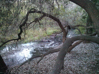
primitive camping where you have to carry your own water, then I highly recommend this place. The ground was carpeted with fallen leaves, large oaks towered above the picnic tables and gravel road, and the night sounds came out just as I was ready to climb into bed.
 |
The "Glory Hole" spillway. Instead of a spillway through the dam itself, this
one takes the water down the middle, through some pipes and into a creek.
(Also, just beyond, is another rope with buoys holding the other curtain.) |
When I'm camping, I go to bed with the sun and wake up with the sun. Very much unlike when I'm in the company of electrified lighting.
 |
| Morning light on the road through Peltier Bridge Campground. |
With the sunrise came the sounds of a distant flock of turkeys, the chilled morning air, and shafts of light filtering through the oaks. I love the quiet mixed with the sounds of water and those small woodland animals scurrying and chirping while making their way in the woods.
 |
| View of Whiskeytown Lake from a rise on the South Shore Road. |
I stayed at that same campsite two nights in a row.
 |
| Camden House. Built in mid 1800's gold rush (out of nearby Clear Creek). |
The centerpiece of this National Recreation Area is the Whiskeytown Lake created by a Dam. I've never seen a spillway such as they have at this dam. It's called the Glory Hole. It's literally a gigantic cement hole that, which when the lake level reaches the top, water spills into this big hole and down into large pipes destined for Clear Creek (up the creek from where I was camped).
 |
| One view of the trail that loops around the old farmstead. |
Also, they've added curtains that hang down into the water, hundreds of feet, on both the inlet and outlet sides of the lake to force the colder water to the bottom. These curtains keep the colder water from mixing with the sun-warmed water at the top. This is all to support the salmon population which require the colder water temperatures to survive -- a clever solution.
 |
| View from the trail into the old farmstead pasture and orchard. |
On the north side of the lake is a nice 4-lane highway. But, I enjoyed the maintained gravel road on the south side of the lake. The slower pace highlighted the wonderful vistas, autumn colors that matched the golds and reds of the surrounding rocks and dirt. A true highlight of this trip.
 |
| At the graveyard on the farmstead. |
In addition to the natural wonders, Whiskeytown NRA has also preserved some human history surrounding the areas gold rush. I went on the
Camden Water Ditch hike that loops around a gold-rush-era farmstead, complete with house, barn, tenat's home, and graveyard. Although I was told of black bear in the area, I saw none. But, I did see plenty of sign ... scat with apples seeds from the old orchard.
 |
At the end of the hike, bridge over
Clear Creek. |
I hope to go back to Whiskeytown again!
originally posted 11/16/2011


